Things to do in North Park, San Diego: Streets, Canyons and Old Landmarks
A plain guide to North Park's walkable center, historic landmarks, Craftsman streets and nearby Balboa Park, for visitors and neighbors.
8 Oct 2026
North Park sits just northeast of Balboa Park, in the middle of San Diego. It began in 1893 as a lemon grove. A merchant named Joseph Nash sold 40 acres to James Monroe Hartley, who wanted to grow lemons. The city grew until it reached the grove, and the name stuck.
Today the heart of the neighborhood is the corner of 30th Street and University Avenue. This guide sticks to places that have been here a long time and are likely to stay.
Start at the sign
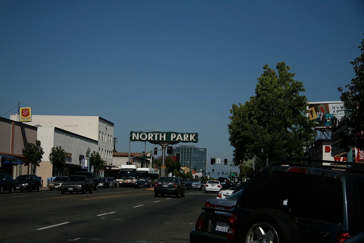
The North Park sign hangs over University Avenue near 30th Street. The current one went up in 1993 and is the third version to mark the neighborhood's main business corner. It is a simple place to begin a walk, and a fine photo stop.
Nearby is the historic North Park Theatre building. It opened in 1929, back when vaudeville shows were still popular and talking pictures were brand new. It was built to host both. The old North Park Water Tower is another local landmark. It is now empty but preserved because it matters to local history. It once held more than a million gallons of water for the neighborhood and for fire protection.
The Stevens building, at 30th and University, went up in 1912. It was North Park's first tall commercial building. Looking up at the older rooflines is part of the fun here.
Streets worth walking
North Park has a high amount of foot traffic compared with many parts of San Diego County. That makes it a good place to leave the car and wander.
The Ray Street Arts District has galleries and a monthly gallery walk. Check the district's own channels for the current schedule before you plan around it.
For houses, head to the Morley Field area. The Dryden Historic District has Craftsman and California bungalows. Many were designed by the builder David Owen Dryden, and Edward F. Bryans also built homes there. The North Park Historical Society, a volunteer group, offers walking tours so you can learn what you are looking at.
Outdoors
Balboa Park touches the southwest edge of North Park. It covers about 1,200 acres and is a National Historic Landmark District. It holds more than 15 museums, gardens, a famous zoo and the Spreckels Organ Pavilion, which has one of the largest outdoor pipe organs in the world. The Botanical Building was the largest wood lath structure in the world when it opened in 1915. You could spend several days in the park and still not see it all.
Morley Field is the sports side of Balboa Park, close to North Park. It has tennis courts, a golf course and a velodrome, which is a banked track for bike racing.
Switzer Canyon runs along the line between North Park and South Park. The city bought it in 1987 and set it aside as open space. It has two walking trails and three places to start. It is a quiet green strip in the middle of a busy city. The canyon is named for E. D. Switzer, who had a five acre farm there in 1869.
A little history
North Park once ran on streetcars. They linked the neighborhood to the rest of the city from the 1910s until 1949, when buses took over. That is a big reason the neighborhood grew up around a walkable main corner, and it still feels like a village in the middle of a large city.
For families
Balboa Park is the easiest family day. The zoo, the museums and the open lawns give kids a lot of choices. Morley Field has playing space too. For a shorter outing, a stroll along Switzer Canyon's trails lets children look for birds and plants in the middle of the city.
When the weather turns
When it rains, the museums of Balboa Park are close by. The North Park Historical Society's website is a good place to read about the buildings before you head out on a drier day.
A short drive away
Old Town San Diego State Historic Park tells the story of early San Diego through restored buildings and living history programs. It preserves five original adobe structures, a working blacksmith shop and several museums. Downtown San Diego and Mission Valley are also close.
Getting around
University Avenue and El Cajon Boulevard are the main east-west roads. Interstate 805 forms the eastern edge. Several bus routes serve the area, and the University Avenue line is the busiest bus corridor in the San Diego region. Walking is the best way to see the center, since the sights sit close together.
Good to know
The main strip is 30th Street and University Avenue. Start there.
Stay on marked trails in Switzer Canyon.
Balboa Park is huge. Pick one or two sections per visit.
Check each venue's own website for current hours and programs before you go.
Parking can be tight near the main corner. Walking or transit helps.
Find local businesses
Planning a visit, or live nearby and need a hand with something? Browse the local businesses listed in the San Diego guide to find who serves North Park and the neighborhoods around it.
Useful links
About North Park: the town at a glance
Own a business in North Park? Claim or add your listing, free
By Thomas Hassett and Eric Andrews, Local Business America
Photo: Lrtman, Public domain, via Wikimedia Commons.
Sources: Wikipedia, "North Park, San Diego" (https://en.wikipedia.org/wiki/North_Park,_San_Diego); North Park Historical Society (https://www.northparkhistory.org/); Wikipedia, "Switzer Canyon" (https://en.wikipedia.org/wiki/Switzer_Canyon); Wikipedia, "Balboa Park (San Diego)" (https://en.wikipedia.org/wiki/Balboa_Park_(San_Diego)); California State Parks, "Old Town San Diego State Historic Park" (https://www.parks.ca.gov/?page_id=663); North Park Historical Society (https://www.northparkhistory.org/); City of San Diego, "Morley Field Sports Complex" (https://www.sandiego.gov/park-and-recreation/centers/recctr/morley); Balboa Park (https://www.balboapark.org/); Spreckels Organ Society (https://www.spreckelsorgan.org/); City of San Diego, "Trail Maps of Open Space Parks" (https://www.sandiego.gov/park-and-recreation/parks/oscp/maps). Wikipedia text is available under CC BY-SA.